Botlink
At Botlink we wrote a variety of very interesting projects in support of their drone platform.
- Wrote a 3D OpenGL based map renderer for android using imagery from mapbox.
- Using game dev techniques, we improved performance 10x over the existing 3D mapping solution.
- Did on-drone photo stitching for agricultural surveys using NVIDIA Jetson boards.
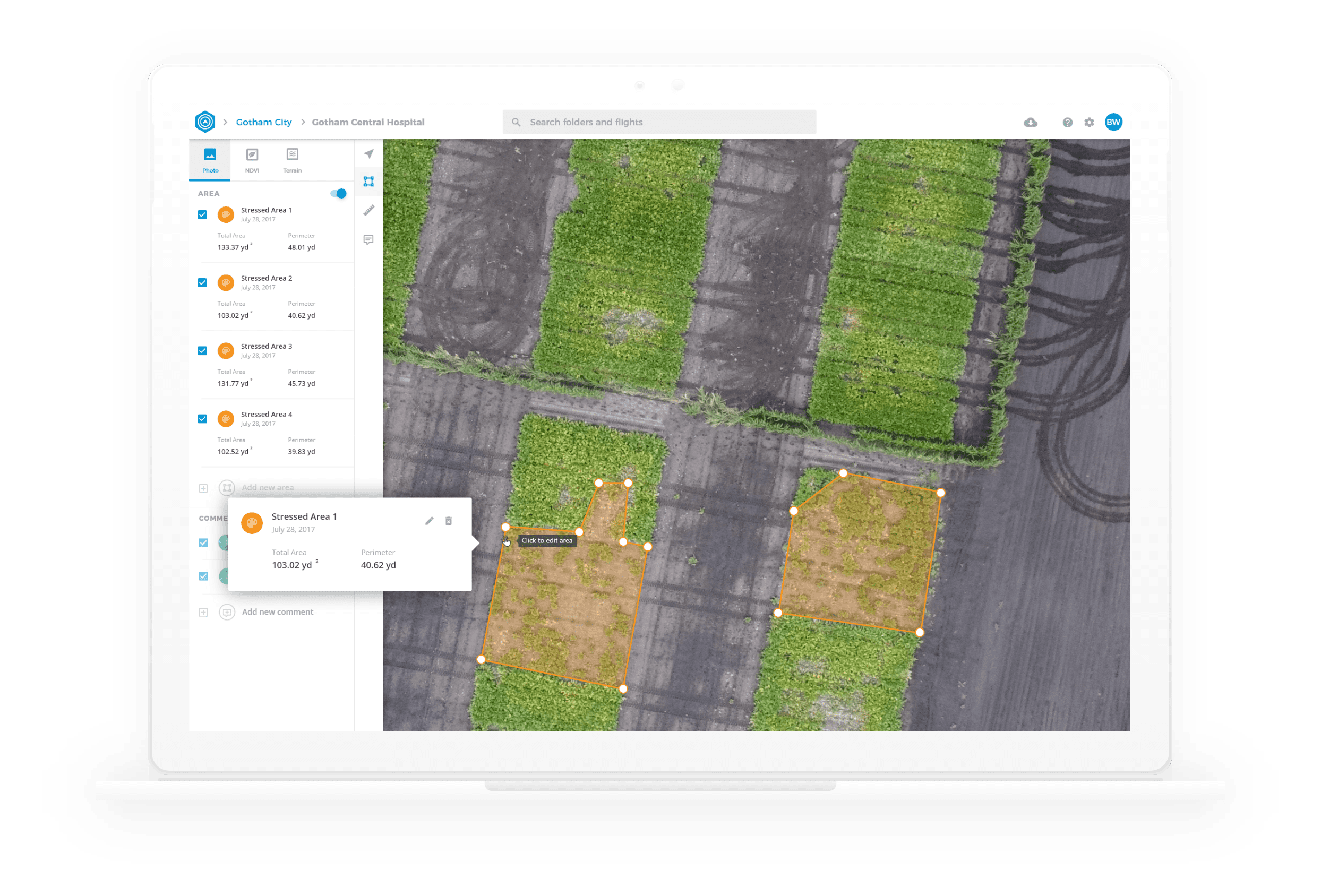
- NDVI imagery for agricultural use.
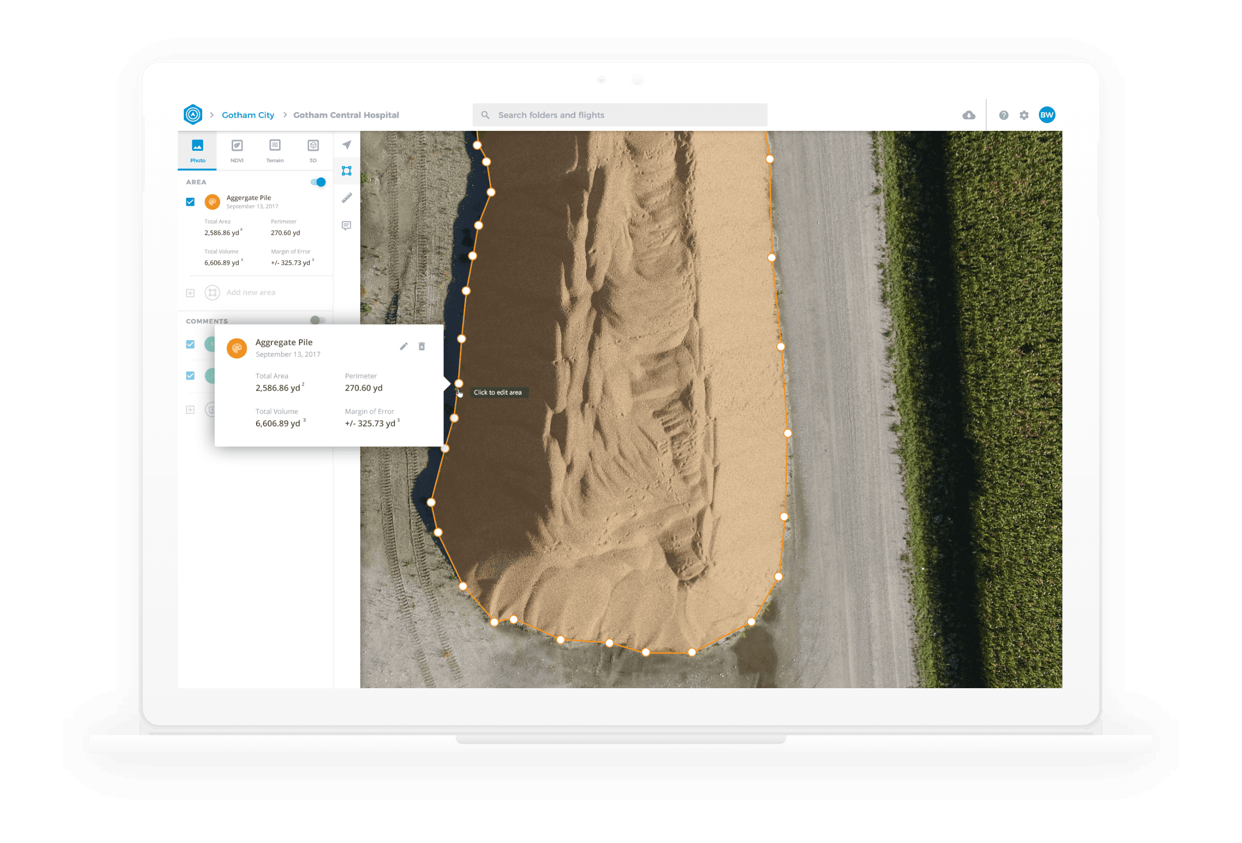
- Using OpenCV for assembling 3D models from drone images, then using the imagery to calculate volumes of bulk material piles.
- Use NASA’s SRTM dataset to create 3D geometry for our mapping solution.
Overall, our work at Botlink really showed us how skills honed in game development can be useful in adjacent industries. The demands for quality and performance in the game development industry allow Scott and me to solve challenges that developers from other industries consider intractable.